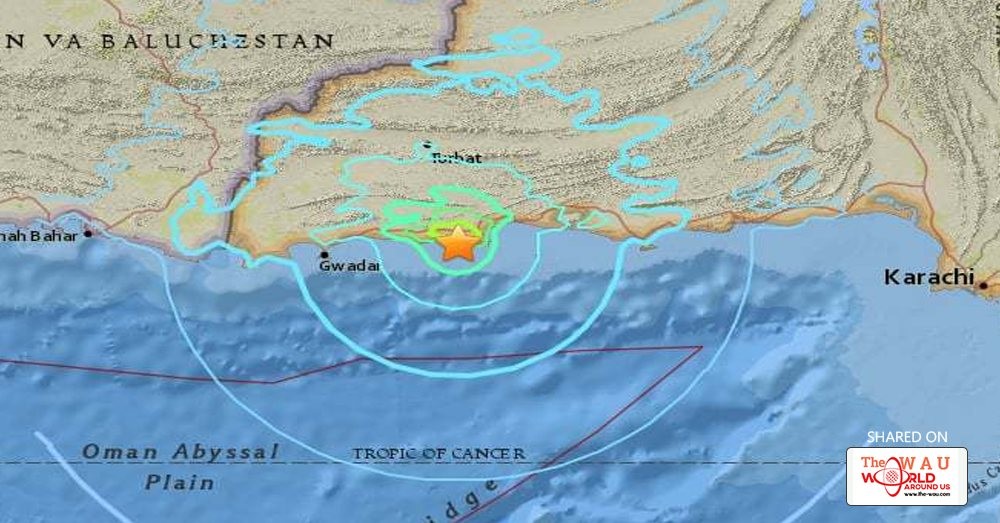
A 6.3 magnitude earthquake hit parts of Balochistan early on Wednesday morning, the US Geological Survey (USGS) said.
According to USGS, the epicentre of the quake was located 20 kilometres west southwest of Pasni at a depth of 25.9km.
The quake struck Gwadar, Makran and Pasni at 3:04am. However, no damage or casualties have been reported.
Provincial Disaster Management Authority (Balochistan) Director General Aslam Tareen said the magnitude of the quake was 6.6.
Residents of the affected areas were woken up by the tremors and ran out of their houses in fear and shock.
Commissioner of Makran Division Bashir Bangulzai told DawnNews that a complete survey of the Makran division had been conducted and no damage or casualties were found.
He added that relief teams have been sent to remote areas of the region to ensure safety of residents there.
Tufail Baloch, Deputy Commissioner Gwadar confirmed that no damage had occurred in Gwadar either.
The Sindh commissioner has been sent to Pasni to survey the area.
A few weeks ago, a 3.6 earthquake magnitude struck Karachi. No casualties reported were reported at the time either.
Pakistan is located in the Indus-Tsangpo Suture Zone, which is roughly 200 km north of the Himalaya Front and is defined by an exposed ophiolite chain along its southern margin.
This region has the highest rates of seismicity and largest earthquakes in the Himalaya region, caused mainly by movement on thrust faults.
Along the western margin of the Tibetan Plateau, in the vicinity of south-eastern Afghanistan and western Pakistan, the South Asian plate translates obliquely relative to the Eurasia plate, resulting in a complex fold-and-thrust belt known as the Sulaiman Range.
Faulting in this region includes strike-slip, reverse-slip and oblique-slip motion and often results in shallow, destructive earthquakes.
The PMD recorded about 851 seismic disturbances in 2015.
Share This Post


