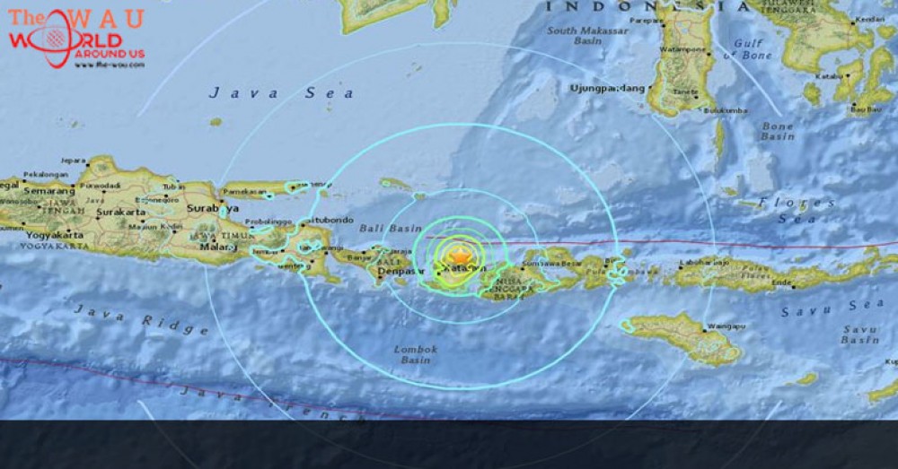
A magnitude 6.8 earthquake struck off the north coast of Indonesia's island of Lombok on Sunday (Aug 5), the Indonesian Meteorological Agency said.
No tsunami warning was issued for the quake, which occurred at a depth of 10 km, the agency said.
Separately, a magnitude 5.6 earthquake jolted the Mentawai Islands in West Sumatra on Sunday afternoon, but no tsunami alert was issued following the quake, the National Disaster Mitigation Agency (BNPB) has reported.
BNPB spokesperson Sutopo Purwo Nugroho said the epicentre was 38 km southwest of Mentawai Islands and around 22 km beneath the seabed.
The earthquake rocked the islands, a favourite among surfers, at 3.56pm local time (4.56pm Singapore time), and strong vibrations lasted for several seconds. No damage or casualties have been reported so far.
In 2010, a magnitude 7.2 earthquake caused a tsunami on the islands - displacing more than 2,000 families living on three affected islands. South Pagai was the worst-affected island, with 900 families who had to be relocated.
Share This Post


