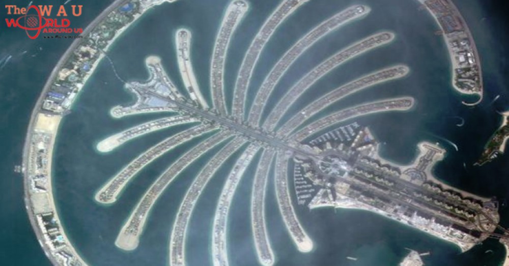
KhalifaSat, the first 100 percent Emirati-engineered and developed satellite, has sent its first photo from space - an image of Dubai's world-famous Palm Jumeirah.
Mohammed bin Rashid Space Centre (MBRSC) published the photograph of the man-made island in a Twitter post on Monday.
KhalifaSat was successfully launched into space from Tanegashima Space Centre in Japan onboard the H-IIA rocket last month.
Images from KhalifaSat, one of the most technologically advanced remote-sensing observation satellites with five patents registered, will be used in urban planning and management, ensuring the effective optimisation of land use and realistic infrastructure proposals.

khalifasat-palm
The images will also be used to develop detailed maps of targeted areas and monitor major engineering and construction projects.
In the field of environmental protection, KhalifaSat will monitor environmental changes locally and internationally to support global efforts to preserve the environment.
The satellite is also expected to provide detailed imagery of the ice caps at the North and South Poles, helping to detect the effects of global warming.
The UAE has plans to launch 12 satellites by 2020, with current estimated investment of AED22 billion.
Share This Post


